Technology in disasters: 3 ways today's telematics, GPS capabilities shine
With southeast Texas still licking wounds from Harvey and Irma already having led Florida to declare a state of emergency, the response to disasters today is relying — and enabled — more and more by improved telematics and GPS capabilities.
It should come as little surprise. Among the many things that have changed significantly in the last dozen years since Hurricanes Katrina and Rita similarly caused catastrophic damage in the Gulf Coast region, one of the most prominent is the now nearly omnipresent smartphone, and with it wireless connectivity. Right alongside have come data and navigation capabilities closing in on the promise of "real time" information.
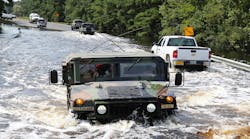
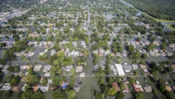
Directly in the aftermath of Hurricane Harvey, as extended heavy rain kept much of Houston and some surrounding areas underwater, Houston Mayor Sylvester Turner may have put it best as he repeatedly referred to the situation as "dynamic." That's the nature of something like a flood, where roads and suddenly become covered over or impassible with downed trees, power lines, debris and more.
Even after flooding has receded, that can still remain the case as water overflows can leave roads and bridges less visibly damaged, possibly to fail in the days and weeks going forward. Long after it stops falling, rain will also continue to seep off into rivers and streams, pushing them beyond their usual boundaries and potentially further eroding infrastructure.
The response and resupplying efforts following Harvey — and perhaps still to come in the wake of this already overly active hurricane season — underscore how today's technology-enabled trucking and logistics network have been able to help get through and return things to normal.
Fleet Owner caught up with Telogis, A Verizon Company, to hear about how telematics, GPS and routing technology have been improving the odds of getting through when it counts, particularly since Telogis' parent Verizon handles telecommunications — another critical focus following a disaster such as Harvey's flooding.
•Providing evermore dynamic routing. As Harvey did its worst, hundreds of roads were simply underwater and inaccessible by road vehicles. But in the days to follow, roads had to be closed "on and off" much more dynamically, including major arteries into and around Houston, Austin and elsewhere, noted Kelly Frey, vice president of product marketing at Telogis.
Note that as of Wednesday morning, Sept. 6, the Texas Dept. of Transportation reported that remaining flood conditions across southeast Texas are dissipating, but "rivers continue to discharge the unprecedented rainfall." The department noted that "closed or flooded conditions are still present on some major and minor routes, and could continue through the week."
Truck routing and navigation today can fold in continually updated reports. "Being able to shut down those roads and navigate around them is really a critical function to provide," Frey said.
In one example of that, Telogis provides its Route Planning Suite and Telogis Navigation, he pointed out, which brings in dynamic information from local drivers on things like unexpected road blockages. Telogis then verifies the information with law enforcement or the local department of transportation; that's important both for re-routing trucks on the move and planning routes from the dispatcher's standpoint.
"We verify that the road is closed or impassible, and then we put it in our [Telogis] Navigation so that trucks are navigating around it," Frey said. "But we also use it in our Route Planning Suite to create routes that won't go along those roads."
•Enabling collaboration. There's a lot more to do in the wake of a massive flood like Houston has experienced than rescue efforts and just resupplying the area with basic necessities such as food and water. Other goods needed to repair and rebuild homes and businesses will remain stretched for weeks or months to come, for one, and there are many other facets to the response such as clearing trees and debris from roads and repairing cellular communications towers.
Frey explained how telematics and GPS can facilitate efforts when outside help arrives, such as utilities companies sending vehicles and workers to Texas from surrounding states. A Telogis/Verizon collaborative function allows for "mutual aid response" so that an outside service provider or agency can share vehicle locations for a limited time period.
"It almost looks like [the outside vehicles and workers] are their own vehicles, and they might be coming from three or four different service providers or utilities," Frey noted. "We've also got law enforcement agencies, fire departments and other first responders on our network, so you can imagine the power of transportation companies, utility companies, service providers like tree-cutting services, law enforcement and first responders being able to 'share' their fleet vehicles and worker locations so they can jointly coordinate a response with something like this."
•Guiding and tracking atypical vehicles and response efforts. When a makeshift army of whatever's needed comes together in a situation like Hurricane Harvey rescue efforts, one thing helping organize, direct and track such efforts is that all-connectivity device in your pocket.
In Houston, "you also had all those watercraft and even kayaks out there," Frey said. "If you've got your cell phone, you've also got location and communication" as long as cellular service is accessible.
"Years ago, it wouldn't have been possible to keep everything connected," he added. "As crazy as it sounds, those [cell phones] were even helping dispatch boats to people who were in distress."
And on that note, it's one more argument for making smartphones — particularly for those who might be pulled into rescue or recovery efforts in a disaster or emergency situation — more weather- and waterproof and impact-resistant.


