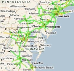
The I-95 Corridor Coalition has announced that it will begin a multi-state program that will combine both GPS technology and road sensors to collect and distribute traffic information, providing speed data and travel time to drivers along Interstate 95, the key North-South thoroughfare on the East Coast.
"The member agencies of our 16-state Coalition identified multi-state availability of real-time traffic data as a key element of achieving our goal to improve transportation services through information sharing and coordinated management and operations," said George Schoener, executive director of the coalition.
The group has awarded a multi-million dollar, multi-year contract to Inrix to provide the technology, which will initially cover approximately 1500 center line miles of freeways and 1000 center line miles of major arterials from New Jersey to North Carolina. Inrix’s contract is initially slated for three years, but can be extended to up to ten years.
Inrix projects the technology will be operational and available to the general public by the summer of 2008. It hopes to eventually expand the system throughout the entire Eastern seaboard, spanning I-95’s entire distance from Maine through Florida.
According to Inrix, the data will be available through travel times on signs, 511 systems, incident management systems, Internet-based travel services, congestion performance measures and other applications.
The company claims this will be the first public-sector program to seamlessly cross state borders to provide real-time traffic information to drivers, including in areas where no data previously existed.
“A lot of our GPS data comes from fleets, which help us power our commercial data,” Ryan Glancy, Inrix senior director of business development, fleet management, told Fleet Owner. “They help us build the content, and we provide that information back to them.”
On the corridor, over 750,000 GPS-enabled vehicles will team with road sensors to detect how slowdowns, accidents, infrastructure collapses, and homeland security alerts will affect congestion, leading to increased safety, Inrix said.
The I-95 Corridor Coalition is a partnership of transportation agencies, toll authorities and other organizations such as public safety, port, transit and rail organizations from Maine to Florida which aims to improve travel conditions for passengers and freight. According to the group, the region handles 565-million long distance trips and 5.3-billion tons of freight per year, representing $3.95 trillion of the nation’s GDP.
