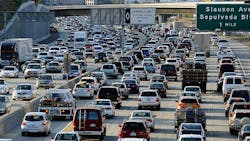
World's worst traffic — and two dozen things being done about it
Mexico City, Los Angeles, San Francisco, New York, Seattle and Vancouver, Canada: they're the North American cities with populations over 800,000 that made the world's top 50 with the most traffic congestion.
Of those large North American cities — this according to GPS and routing technology provider TomTom's latest worldwide traffic study based on 2015 data — all but Seattle and Vancouver had traffic congestion increases from the prior year. For perspective, Mexico City ranked as the world's most congested big city: there, drivers spent an average of 59% more of their time getting around compared with drivers in free-flowing traffic conditions, or an average of about 1 hr. 35 min. to every free-flowing traffic hour.
In Los Angeles, it was an average of about 1 hr. 25 min. vs. an hour driving in free-flowing traffic, according to the study.
Meanwhile, among the top 50 most congested big cities, Europe had 14 overall. Notably, Russia had two of that total and the most congested big city for the continent: Moscow, which was ranked fifth globally. But there and in St. Petersburg, which came in at 11th most congested globally, were found Europe's largest traffic congestion declines (6% and 4%, respectively).
Why's that important? Because this year, TomTom profiled a group of cities and what they're doing to reduce traffic, with strategies for things like reducing vehicles on the road, improving the flow of freight and encouraging more people to walk, bike or use public transit. Over the last few years, Moscow has put in place a number of measures to reduce traffic, including:
1. Charging for and restructuring parking on busy roads to encourage the use of public transit.
2. Adding new metro lines and bus lanes, speeding up public transit times.
3. Putting in place a new traffic circulation plan in the city center.
4. Adding pedestrian and cyclist infrastructure.
5. Improving travel/transit information provided via television and radio.
Being we don't read Russian, that's about as far as we got on Moscow's transit improvement efforts. But the TomTom study also profiled Pittsburgh, among other cities. There, according to Akshali Ghandi, transportation planner in the Dept. of City Planning:
1. The department is moving forward with its Mobility Plan, Complete Streets Policy and Bus Rapid Transit planning project with an overarching goal "to put pedestrians, cyclists and transit riders on equal footing with motor vehicle drivers."
2. The city is exploring adaptive traffic signal control in congested urban corridors.
3. Extensive research is being done on autonomous vehicle deployment.
4. The city is investing in "a network of sensors mounted on city-owned street lighting infrastructure designed to monitor everything from air quality to real-time traffic patterns."
And about 300 miles or so to the north in Toronto — another profiled city — Janet De Silva, president and CEO of the Toronto Region Board of Trade, notes there's some of the "worst congestion and longest commute times" in North America. But on the way to help change that, she adds, is a regional transportation plan called the Big Move by Metrolinx, a transportation improvement agency the province of Ontario created in 2006.
A full review of the Big Move 25-year plan — which might've more appropriately been called the "Massive Move" — is due in mid-2016. Not in the TomTom study but rather the Big Move's baseline report you'll find 10 strategies:
1. Build a comprehensive "rapid regional transit" network involving expansions of existing — and creation of significant new — rail and subway lines.
2. Expand "active transportation," including pedestrian bridges and walkways; bicycle paths and long-distance routes; and multi-use tunnels.
3. Improve freight movement — truck-only lanes, for instance, are being studied for dense urban areas.
4. Improve the road and highway network's efficiency with things like new carpool facilities, HOV (high occupancy vehicle) and bus bypass lanes, and new highways.
5. Advance policies that support lower emissions and transportation choices like carpooling, walking, cycling, and transit to encourage commuting options that reduce the number of vehicles on the road.
6. Provide easily accessible information on transit/commute options, transportation conditions and route planning.
7. Create an integrated regional fare system so users can cross municipal lines or different transit modes without having to pay duplicate fares for a single trip.
8. Encourage communities with stores and services located more densely so more people will travel by foot, cycle and transit.
9. Plan for universal access to transit and transportation services for persons with disabilities.
10. Commit to continuous improvements through things such as coordinating data and best practices/common approaches and transportation research.
A wealth more information can be found in TomTom's study on the world's most congested cities and not only what's being done and economic implications, but what you can do today to avoid existing traffic snarls such as these five things below. TomTom's product offerings for fleets, TomTom Telematics, and for consumers are designed to help particularly with 1-3:
1. Use real-time traffic and dynamic routing information for more accurate, fluid information.
2. Try a new route your GPS system suggests.
3. Check out traffic conditions before you depart.
4. Plan to travel outside of typical peak congestion times like rush hour.
5. Consider walking, bicycling or taking public transit where possible.
About the Author
Aaron Marsh
Aaron Marsh is a former senior editor of FleetOwner, who wrote for the publication from 2015 to 2019.
